“A path is created where one walks.”
Zhuangzi, 3rd century BCE
The A to Z of the Israel National Trail
Introduction
For many years, I dreamed of creating my own path along the Israel National Trail. I felt bound by the divine command to Abraham: “Arise, walk through the land in the length of it and in the breadth of it; for I will give it unto thee” (Genesis 13:17), as a commandment every Jew should strive to fulfill with his own feet. I felt compelled to witness, with my own eyes, the truth of the words spoken by Joshua and Caleb: “The land, which we passed through to search it, is an exceeding good land” (Numbers 14:7).
And there was also business motivation. As the owner of a company specializing in relocating foreign executives and experts to Israel, I felt the need to present the country to them, introducing its beauty, heritage, and diversity. What could be more appropriate for this than walking the Israel National Trail? I planned to initiate a project of guided walks along the trail for these executives and experts, and I considered my own first-hand familiarity with the trail an essential condition for the project’s success. And so, in 2025, we are planning to launch the initiative.
The initial idea was to hike the entire trial in one go: starting on the seventh day of Pesach and completing by Shavuot. But I dropped the idea and ultimately decided to hike the trail in two-day sections each week. The original plan was to set out on Simchat Torah of 5774 (7.10.23), but at the last minute I chickened out without knowing what I was freaking out about.
Everyone was affected by the events of Simchat Torah 5774 (October 7th) in a different way. The day after that horrible and terrible day, I made a commitment that next year I would set out on Simchat Torah and complete the trail by Shavuot. For a year I trained by strenuous walking on the coastal cliffs opposite Netanya, my hometown. My son, David, joined me, and together we walked the trail. I “recruited” my brother, Yoel, as the “logistics officer” of the journey: he drove us to the starting point of each section, picked us up at the finish, and prepared our lodging.
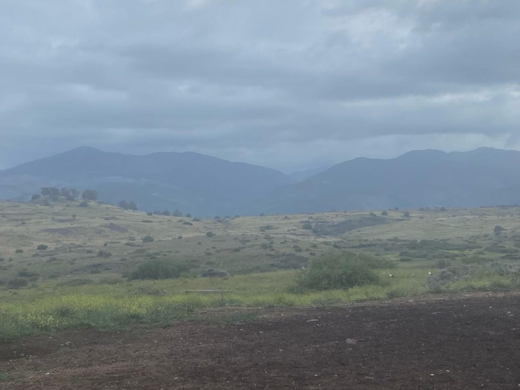
The decision was to hike the trail from south (Eilat) to north (Mount Hermon). As a ninth-generation native of Safed, I have always gone up to the north – never down from it…In hindsight, it was the right choice: we spent the autumn and winter months in the south and reached the north at the height of the spring bloom.
On the seventh day of Sukkot, 5785 (22.10.24), we set out from Eilat’s southern shore and began our journey. We did not camp in the open; once a week we would stay in a hotel or rent a guest apartment. This allowed David and me to feel as free as songbirds, carrying only a few liters of water. We were highly focused on making progress along the trail and almost never strayed from it. As a result, we advanced quickly, and on some days even completed two sections of the trail (there are 56 sections in total) in a single day. Except for one week, we made sure we moved forward every single week, and by the time Passover approached, we realized we could finish the trail during the holiday itself rather than wait until Shavuot. Indeed, on the eve of Second Passover, we arrived in Neve Ativ and celebrated the eve of the Holy day there with our extended family in a guest apartment. The next morning, joint by many of our family members, we set out for the final five kilometers – from Neve Ativ to Mount Hermon – thus completing the Trail in 26 weeks.


For those planning to undertake the Trail, or sections of it, I have compiled the impressions and insights we gained from our complete experience (A to Z) of the trail
Accommodation
Some hikers sleep in the night camps scattered along the Trail. This requires preparation, which includes carrying a heavy load. We preferred to stay in hotels and guesthouses, which necessitated being driven to the start and picked up at the end of each section (see “Transportation”).
Blisters
During the first two months I suffered from blisters, which were initially caused by worn-out shoes (see “Clothing”) and later by adjusting to new shoes. During the hike itself, the blisters are bearable after the first few hundred meters, and only towards the end of the hike does the pain become noticeable with every step. My dermatologist, surprised by the severity of the blisters (“I only see blisters like this in infantry basic training…”) advised me to take warm water baths every evening. This indeed sped up the healing.
Breaks
Our commitment to the goal has led us to keep breaks to a minimum, except for short breaks of 2-3 minutes each time. This is recommended for those whose physical fitness allows it, as long breaks hinder the pace of progress.
Clothing
The most important item is footwear. For two years, I trained wearing hiking boots to make them to fit my feet, ignoring their wear and tear. For that, I paid a high price (see “Blisters”). I had to switch to new boots, and it took several weeks of blisters until my feet adjusted to them. It is recommended to start training in new hiking boots about three months before the actual start of the journey.
Clothing included long lightweight hiking pants, a long-sleeved Dri-FIT shirt, and a wide-brimmed hat. This outfit protected me from the sun as well as from scratches, insect bites, and gashes.
Drinking
David carried a backpack with a 3-liter water bladder plus two 1.5-liter bottles. I carried three 1.5-liter bottles. At no point did we feel the amount of water was insufficient. Once we left southern Israel, we allowed ourselves to reduce the amount of water we carried due to the many points where we could obtain drinking water.
Energy Management
Walking only two days a week allowed us to physically recover and heal from blisters and muscle strain between sessions. During the hikes themselves, we aimed for a steady pace of between 3 and 5 km/h, depending on the terrain conditions. This enabled us to complete two consecutive sections on some days and cover more than 40 kilometers on others.
My weak point was relatively low burst power, so I did the uphill ascending at a slow, winding pace (when the terrain allowed). On one occasion, when I “pushed” my strength beyond the limit, I paid for it with nausea and vomiting. I learned to listen to my body and saddle it only with what it can bear.
Fellow Travelers
In the very first kilometer of our journey, which began in Eilat, we met two hikers who had ascended to Eilat and told us that this was their last kilometer on the Trail. This was probably “beginner’s luck” as they were the first and last hikers we encountered whose goal was to complete the Trail in its entirety. We occasionally met hikers doing a single section or 2-3 sections. We would stop and chat with those we met seeking advice and information about the sections they had completed. Except for large groups we encountered on popular routes (like in the Ramon Crater and Wadi Amud) or when hiking across urban sections (like Jerusalem and Tel Aviv), we didn’t meet more than 10 to 20 people per day and often even fewer.
We heard a lot about the “Angels of the Trail” but haven’t met them along the way (to be honest, we weren’t really looking for them either…). In two places we found “Hug points” for the Trail hikers: in Sapir, a container of cold water was waiting for us, and in Kfar Hasidim, a rest hut with cold drinks had awaited. The one in Kfar Hasidim was a perfect contrast to Kibbutz Yagur, where we had passed shortly before and weren’t able to find a single marking of the Israel Trail (which made us feel unwelcome…).
We saw the human mosaic that makes up Israeli society not only in the contrast between the Kfar Hassidim and Kibbutz Yagur. There were hikers who stopped to warmly chat with us, and there were those who passed us by without so much as a response to our greeting. There were jeep drivers who stopped beside us to ask if we needed water or any other help, and there were those who didn’t even glance in our direction. There were off-road motorcyclists who slowed down as they passed by us to avoid kicking up a cloud of dust, and there were those who sped past dangerously close, spraying us with flying stones. Am Yisrael Chai! (The people of Israel live!)
Food
The travel style we chose (being driven to the start of each section in the morning and picked up in the afternoon) didn’t require us to carry a significant amount of food. We usually ate breakfast with plenty of proteins and carbohydrates and had a hearty dinner at a hotel or restaurant. I brought with me dates stuffed with nuts, 2-3 energy bars, and 2-3 clementines.
Gear
We minimized the gear we carried as much as possible. Besides water (see “Drinking”) and a little food (see “Food”), our backpacks contained raincoats in case of rain, a flashlight in case we got stuck in the dark, first aid kit and a portable phone charger. After a few weeks and upon talking to several hikers, I started using a walking stick (just one), which helped me greatly on ascents, and stabilized me on descents and challenging sections.
Injuries
When planning the hike, my greatest fear was injury. I heard from many people about serious injuries that prevented them from continuing. Because of this, I made sure to cover almost all parts of my body (see “Clothing”) to avoid scratches and gashes that would develop into inflammation, and I tried to be careful during challenging hiking sections.
But it only takes a moment of distraction. The first time was in section 44 (Gav Hulit – Nahal Gvanim). Upon completing the ascent from Nahal Ma’uk, the colorful and majestic view of the Ardon Valley and the eastern part of Ramon Crater was revealed to us. Awestruck by the scenery, I missed a small bump in the ground`. I fell forward onto my hands, but my hands didn’t prevent my chin and knees from hitting the rocky ground. Fortunately, my palms absorbed most of the impact, so I only suffered relatively minor injuries and pain in my chin, palms, and knees that lasted for several weeks.
The second time I was inattentive, I was less fortunate. In section 33, we were ascending from Masada towards Nahal Anaba. On flat terrain, I looked away from the hiking trail for just a second and stumbled. This time, I didn’t have time to break the fall, tacking a hard blow on my chest, which caused two ribs to break. Luckily, breaking both ribs didn’t prevent me from continuing the hike that day and in the following weeks, as it didn’t damage my respiratory system and as I wasn’t carrying much gear anyway (see “Gear”). This fall made me double my caution for the rest of the Trail and take extra care with every step whispering to myself on challenging sections “you do not have any more ribs to spare.” In the language of Zen Buddhism, with every step I was focused on the “here and now”. Since we walked about 50,000 steps on an average day, I had 50,000 moments of concentration daily. Without a doubt, a great mental workout in concentration and self-control!
The extreme caution I have shown since the Masada ascent has proven itself, and even when I occasionally tripped, I was alert enough to avoid significant injuries.
Moments of Breakdown
The only moments of breakdown were during the few rainy days we experienced (see “Rain”). We did not experience any additional moments of breakdown along the Trail. When the goal is clear and within reach, there is no reason for moments of breakdown.
Navigation
We used the Israel National Trail map binder published by the Society for the Protection of Nature. The maps are very convenient to carry and provide a reasonable representation of the terrain. On several occasions, we discovered inaccuracies in the maps, which forced us to rely on navigation apps, which delayed us and “devoured” our mobile phone batteries. The inaccuracies resulted from changing terrain conditions (such as in segment 31 between Arad and Har Amsha, where Bedouin vehicles have created countless new paths in the desert plain) and partly from errors by the map editors (such as in segment 25 between Mitzpe Modiin and Tel Afek).
Navigation Errors
The Trail markings are not perfect (see “Trail Markings” and “Navigation”), which occasionally caused navigation errors. We were not overly stressed by such errors but rather aimed to keep moving forward and return to the Trail route later (when this did not involve risk) or simply go back a few hundred meters to discover the error. When planning the number of hiking hours, it is recommended to always take a factor of about an hour as possible compensation for navigation errors.
Passability
We did not discover any significant problems with the terrain passability conditions. Indeed, there were challenging sections that required great caution, but they usually included railings, ladders, pegs, and ropes enabling safe passage. Of course, there were sections where we had hoped for another peg and another railing, but the Trail provides hiking conditions that allow both young children and those with less physical skills to traverse them. We greatly appreciated the work that was put into the Trail’s passability in certain sections. This was the case when we reached Ein Shaviv (section 41) and discovered a huge grove in the middle of a desert of dense vegetation of Euphrates poplar trees and reeds. The grove would not have been passable if it were not for the enormous work that was put into clearing the pathway, which certainly requires constant investment in ongoing maintenance. This way, we were able to enjoy the experience of hiking in savannah conditions in the midst of an arid desert.
Physical Fitness
One must arrive with level of physical fitness enabling completion of at least 25 km per day of a non-challenging hike. This level of physical fitness allows one to complete 15 km of a challenging hike. There are sections that must be completed in continuous sequence (such as Nahal Efran – Oron), which require such physical fitness.
Preferred Sections
I chose my 12 favorite sections (from north to south):
- Section 3, Tel Hai – Metzudat[1] Koach: Starting and finishing at two landmarks of our 100-year war to conquer the land. A wonderful view of the Hula Valley, the Golan Heights and Mount Hermon. A real treat at the end of the route: the Nahal Kadesh Canyon
- Section 9, Migdal – Havat Kinneret: Ascending to Mount Arbel, the Swiss Forest promenade overlooking the Kinneret
- Section 14, Yagur – Nahal[2] Oren: “All year-round green mountain”, Nahal Hik, Har Shokef, Nahal Oren
- Section 20, Tel Aviv – Tel Afek: From the river mouth of the Yarkon to the springs of the Yarkon, leaving the dense urban center into a surprising savanna of reeds and ending in Tel Afek with its many springs and pools of water.
- Section 23, Latrun – Tsova: Latrun Citadel, Burma Stream, Kisalon Stream, the Forest of the Martyrs and Tsova with a wonderful view of Jerusalem
- Section 34, Masada – Ein Bokek: Masada from the lesser known but more impressive southern side, Masada Stream, Dead Sea Viewpoint, Mor Stream
- Section 37, Nahal Tamar – Nahal Akravim: Tamar Stream, Tsofit Stream, the Small Crater
- Section 39, Oron – Nahal Efran: A challenging hike along the “cockscomb” of the Large Crater and an equally challenging descent into Efran Stream. Without a doubt the most challenging section of the Trail
- Section 42, Nahal Hava – Mitzpe Ramon: Nahal Hava with its unique geological faults and ridges, a unique view of the Ramon Crater
- Section 44, Nahal Gvanim – Gav Holit: Mount Saharonim. Shaar Ramon. Parsat Nekraut. Karbolat Haririm. Nahal Geld. Gav Holit.
- Section 48, Nahal Barak – Tzihor Junction: Barak Canyon, Ramat Barak, Verdit Canyon, Nahal Paran and Nahal Tzihor
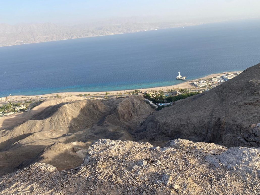
- Section 56, Mount Yehoram – Eilat: A section that has it all: canyons, spectacular viewpoints, mountains and rocks in a variety of colors, and the Red Sea.
Rain
On Yom Kippur, the High Priest would “say a short prayer in the Outer House… ‘May it be pleasing to You, O Lord our God and the God of our fathers… do not let the prayer of passersby enter before You’” (Babylonian Talmud).
The year of the journey (2024-2025) was a year of severe drought, and I hope my prayers weren’t the cause. Throughout the entire journey, we encountered only two rainy days – but those two days were enough to grasp the power of the travelers’ prayer. The first time was between Dvir and Tel Keshet, where slogging through the mud forced us to abort at Beit Kama Junction. The second was during the descent from Mount Tabor, which became extremely dangerous due to the rain, and it took us over 45 minutes to cover a section less than a kilometer long.
It is recommended not to set out on a day when there is more than a 30% chance of rain. Beyond the unpleasant experience, there is also a considerable safety risk involved.
Shortcuts
We didn’t deviate from the hiking trail as a matter of principle. The only shortcuts we allowed ourselves were in wide stream channels (like Nahal Barak) where we “cut” the turns and shortened the route by a few hundred meters.
Skipping Sections
At the beginning of the journey, we decided not to skip any section of the Trail. Perhaps we were too rigid in our determination. Sometimes the Trail’s route deviates from the logical path (like in section 48, from Tzehor Junction to Nahal Barak, where the route veers about two kilometers off the logical course to reach a night camping site). Also, there are sections lacking charm and uniqueness (such as section 49, from Shizafon Junction to Tzehor Junction, which runs, for the most part, along the edge of Route 40). Those who come mainly for the beauty largely hidden along most of the trail can afford to miss a few sections without any qualms.
Time
In the first section we did (Eilat – Hari Yehoram), I made a serious time-planning error assuming we could finish the section in under four hours. We started the section at 2:30 PM and by 5:30 PM we realized that we would not be able to complete the section before dark. Luckily, we had the option to leave the trail and reach Highway 12 within about an hour, arriving there in complete darkness. We made no such mistakes afterward, both because we already had a better understanding of the expected pace and because we took a safety margin for delays due to challenging sections and navigation errors.
However, we might have been about to make another mistake but were stopped by a nature reserve ranger. When we hiked the section from Nahal Hava to Hod Aqev, we arrived at Ein Aqev at 4:00 PM, with about an hour left before sunset. We estimated that the time would suffice for the ascent and descent of Hod Akqev, but we encountered a determined ranger who physically blocked our path and threatened to call a police helicopter… We did complete the section in less than an hour on the next morning, but the descent from Hod Aqev made it clear to me that the ranger was right in refusing to allow us to take the risk.
We tried to set out before seven AM and walk until sunset. On Fridays we were also limited by the need to reach home before Shabbat. During wintertime, time constraints sometimes reduced our hiking hours to 4-5 hours a day. The further north we went, the less time we needed to reach the starting point. After December, we also enjoyed the lengthening of daylight hours. The switch to daylight saving time made us feel like we had extra time…
Trail Markings
On about 80% of the Israel National Trail, the trail markings are excellent, leading you safely along the correct route. The problem lies in the other 20% of cases, where you arrive at pathway junctions and have to guess the correct turn. There is noticeable inconsistency in the marking efforts: in some sections, you walk through a wadi[3] that doesn’t allow any deviation and find markings at every step, while in others you’re in an open plain without clear paths and see no markings for hundreds of meters. Ultimately, one needs to consider that imperfect marking will cause navigation errors and factor them in as part of hiking the Trail (see “Navigation Errors”).
Transportation
As mentioned, we were dropped off at the start and end of each section – without a doubt a real treat. However, there are five points in in southern Israel that require a 4X4 vehicle for pickup and drop-off: Be’er Milchan, Gev Hulit, Nahal Hava, Ein Aqeb, and Nahal Efran. Not every 4X4 owner can reach these places, as reaching them involves complex navigation and a route that changes frequently due to floods. A driver who knows the terrain well is essential. In Be’er Milchan and Gev Hulit, these were local tour guides, and in Nahal Hava, Ein Aqeb, and Nahal Efran, it was a Bedouin resident of the area.
Weather
Moderate weather is, of course, preferred. However, cold weather is fine as well. Hot days were more tolerable to me than to my son and in several cases, we finished earlier in hot days.
Zen
The trail is a true Zen experience. Being completely absorbed in the trail, the focus on each step, the time to meditate and the need for self-control.